CNN
—
A wide-reaching storm is forcing water rescues, knocking out power and creating dangerous travel conditions as it hits the Ohio Valley, mid-Atlantic and Northeast Thursday.
It’s a preview of the frenetic winter storm activity to come this month with at least two others expected into next week.
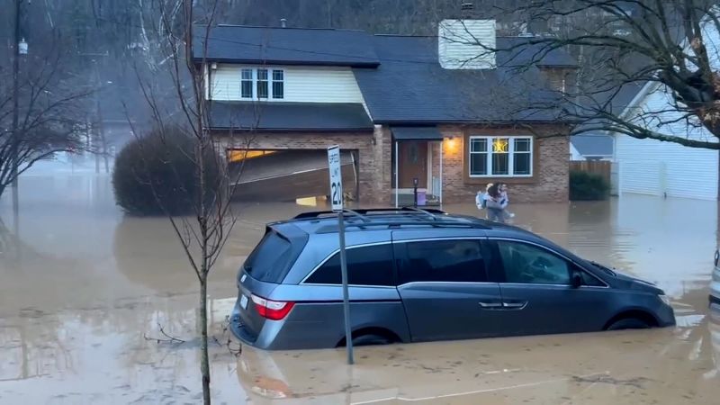
Very heavy rain on the southern, warmer side of Thursday’s storm prompted the first flash flood emergencies of the year in parts of eastern Kentucky and West Virginia. Flash flood emergencies are the most severe level of flash flood warning and indicate that life-threatening flooding is occurring.
“Numerous water rescues” took place in parts of West Virginia’s Kanawha and Cabell counties, where Charleston and Huntington are located, according to National Weather Service warnings.
“We can’t stress enough to not drive through high water for any reason at all,” first responders in Kanawha County urged on social media Thursday morning after reporting crews had been out on “multiple water rescue calls.”
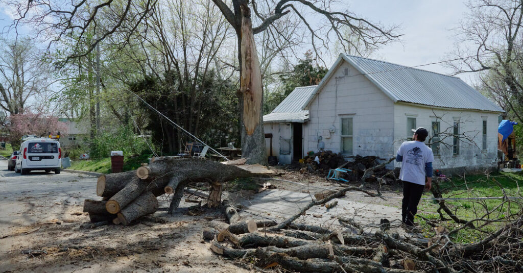
There were also multiple tornado warnings as a line of severe thunderstorms tracked across Kentucky and into West Virginia Thursday morning. At least one confirmed tornado spawned from these storms near Booneville, in eastern Kentucky’s Owsley County.
Power outages from the storm’s ice and severe thunderstorms were ticking upward Thursday morning. More than 85,000 homes and businesses were without power in Ohio, West Virginia, Virginia and Maryland as of 8 a.m. ET.
An icy mix stretched from central Virginia into Upstate New York and parts of New England Thursday morning — including in Baltimore, Philadelphia and New York City.
Dangerous amounts of ice will build up in parts of Pennsylvania, western Maryland and West Virginia. This amount can weigh down trees and power lines — causing power outages — and make travel dangerous to borderline impossible.
The ongoing storm created hazardous travel conditions Wednesday night into Thursday morning as it spread a sloppy mess of icy precipitation over much of the Midwest and parts of the Northeast. Traffic crashes were reported in Illinois, Michigan, Ohio and Pennsylvania.
Flight delays and cancellations were also stacking up Thursday morning. More than 500 flights into or out of the US were cancelled and 1,600 were delayed. Airports in Philadelphia, Washington, DC, Boston and the New York City area were experience the most issues.
Snow, sleet, freezing rain and rain will expand farther north and reach much of New England by Thursday afternoon, but southern parts of the Northeast will gradually change over from an icy mix to rain as warmer air arrives.
Precipitation will come to an end by the evening for much of the Northeast but linger into the earliest hours of Friday morning in northern New England. It will remain slick where air temperatures remain near or below freezing.
The ongoing storm is just the first of an incredibly active stretch of winter storms expected across the northern tier of the US over the next week or two.
The jet stream, essentially a river of air in the atmosphere that storms flow through, is locked in an almost perfect line from west to east, and will continue to funnel storms across the northern tier of the Lower 48.
New storms will arrive every few days until the jet stream shifts — something that might not happen until the second half of February.
The next storm will take less than 72 hours to go from coast to coast. It will push into the West Coast Thursday night, track through the northern Rockies and northern Plains Friday before strengthening Saturday. Saturday into Sunday it will quickly spread a mix of snow, sleet, freezing rain and rain across an area nearly identical to this week’s first storm in the Midwest and Northeast.
The storm’s exact timing, type and amount of precipitation are still coming into focus, but another bout of disruptive icing is possible for the Midwest and Northeast. Some areas will only have a little over 24 hours between when impacts from the first storm end and troubles from the second one begin.
Additional storms are possible next week for the eastern half of the country as the active pattern continues. Forecast models are hinting at another wide-reaching storm next Tuesday and Wednesday, and yet another storm around the middle of the month.


